Image Source: LivingLandscapeArchitecture. Source License: CC BY 2.0. Adaptations: cropped.
Mixed use refers to a mix of land uses in close proximity. It is applicable at scales ranging from a single site to a full district. There are four types of mixed use: vertical mixed use, mixed use districts, mixed use developments, and urban design guidelines / form-based codes.
Why is this important to your community?
Most zoning codes developed in the post-war 1950s and 1960s were created primarily to prevent the urban ills of congestion, and the health and safety impacts of industrial uses in close proximity to housing. Consequently, most conventional codes emphasized the separation of uses, setbacks between buildings, as well as between buildings and streets, and provisions for maximum automobile parking. Suburban areas that developed under these codes are generally not very walkable due to the separation of housing from other uses, large expanses of parking, and streets with major intersections needed to accommodate the automobile use this development pattern mandated.
With renewed interest in urban development in the 1990s came an understanding that, as one person has said, “the bench outside Floyd’s Barbershop in Mayberry was an ‘urban space’.” Most of the smaller towns that never developed large suburbs always had a mix of uses, and larger communities have come to recognize that deliberate mixing certain uses is beneficial in achieving greater land use efficiency, reducing demands for parking through greater walkability, and increasing levels of day and nighttime outdoor activity by combining complimentary uses such as housing with retail and office uses. Development shaped by design guidelines that relate buildings to “complete streets” (accommodating pedestrians and cyclists, as well as cars) and civic spaces also tends to result in more memorable places characterized by a sense of connectedness and community.
Through the CONNECT Our Future process, residents emphasized time and time again that compact, vibrant downtowns, towns and cities are important to quality of life, health, and the local economy.
By placing complimentary uses and activities in close proximity, people are able to choose to walk or bike for short trips. This reduces time spent in cars, improves public health, reduces demand for parking, and provides for more efficient use of land. Design guidelines result in the creation of “places” rather than random scatterings of unrelated buildings and activities, making communities more desirable by maintaining community character as growth occurs, and sometimes improving community character if separated uses are redeveloped in more vibrant patterns.
Where is it appropriate to use?
What priorities does it address?
What other tools are related?
- Subarea Plans
How does it work?
Mixed use development is facilitated by zoning codes that allow a range of complementary uses suited to a specific context, coupled with design guidelines. Areas suitable for mixed use include an urban center or downtown of any size, a highway corridor, “urban” neighborhoods in or near town centers, universities or large medical campuses, and large planned developments such as Baxter.
There are four types of mixed use:
Vertical Mixed Use
Vertical mixed use occurs in single buildings, or clusters of connected buildings which incorporate two or more complementary uses, such as offices or apartments above ground-floor retail businesses –a pattern common in downtowns and along Main Streets. Salisbury, Shelby, and Statesville are all seeing a resurgence in the market for loft or apartment living over their downtown buildings.
Mixed Use Districts
Mixed use districts are areas where one well-established use may predominate, but where complementary uses are appropriate and encouraged. Examples include older residential areas within which small, walk-to "corner stores" or small neighborhood shopping areas can be accommodated, or a downtown where shops, restaurants, hotels and housing are intermingled and within walking distance of office uses. NoDa, Dilworth, and SouthEnd in Charlotte are all examples of this type of development.
Mixed Use Developments
One type of mixed use development consists of centers that combine a mix of uses and activities acting as multi-purpose destinations. Examples of this type of development include the pedestrian-oriented lifestyle centers that are being used in many communities to replace aging suburban shopping malls (Birkdale Village in Huntersville is a good example). These centers are characterized by shared parking and strong pedestrian linkages, where a variety of activities such as shopping, dining, and entertainment can be accommodated by a single trip and parking once. In particular, the introduction of higher density housing into such mixed-use centers can serve the needs of those who choose not to (or cannot) rely on the automobile for their daily activities. This type of development therefore promotes the use of public transportation.
Another type of mixed use development, large-scale "planned developments," is designed to integrate a variety of complementary uses. Examples include traditional neighborhood developments (TNDs) which simulate urban settings with a compact, walkable mix of varied housing types, as well as neighborhood shops, services, schools, and recreation activities (Baxter Village in Fort Mill). Another example is the planned office park that incorporates complementary activities such as hotels, restaurants, recreation, health clubs, day care, and workforce housing to meet the daily needs of workers and visitors.
Urban Design Guidelines / Form-Based Codes
Urban design guidelines seek to influence the siting, scale and arrangement of buildings in relation to each other and to streets and civic spaces to create functional, livable and memorable places. Urban design guidelines may be voluntary or mandatory and applied in specific zoning districts, or in overlay districts.
Many communities are adopting form-based zoning codes in specific districts or community-wide. Form-based codes provide specific guidelines for the form and shape of buildings, specifying “build-to lines,” creating pedestrian-friendly outdoor corridors, and often require parking to be placed in the rear or surrounded by active uses to reduce the visual impact of cars and parking lots. In contrast to conventional codes which seek to separate uses and activities, form-based codes allow a broad mix of uses and activities. Whether guideline or code, both can be tools for “maintaining community character” as growth occurs.
Ready to get started?
Using the Tool
- Examine existing zoning districts to identify limitations or prohibitions on uses that may be complementary and compatible with the current prescribed use.
- Identify areas of the community that may benefit from a mixture of uses. Examples may include a downtown or Main Street, a highway corridor’s node(s) or neighborhood in transition, an area adjacent a university, medical center or other activity center or destination.
- Search for mixed use districts in other communities that are of like size and mix of uses. Seek a copy of their development code to study the types and classes of uses allowed.
- Meet with stakeholders including property owners, prospective developers, and neighborhood organizations to share mixed-use information and benefits, and to measure pubic interest and support for mixed use development. Meeting early and often will ensure that public concerns are addressed in planning and will build support.
- Revise zoning codes to allow mixed use development through new mixed use zoning districts, overlay districts or form-based codes.
Partners
Where has it worked?
Uptown Charlotte - Charlotte, NC
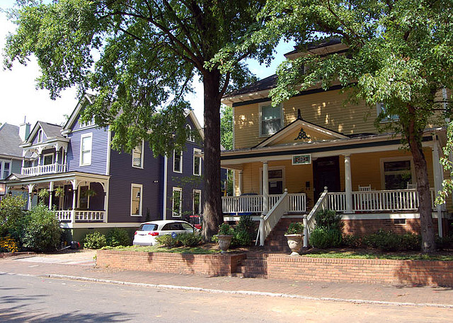 Image Source: James Willamor. Source License: CC BY-SA 2.0.
Contact
Charlotte Center City Partners
info@charlottecentercity.orgAbout the Program
Charlotte’s City Center, known locally as Uptown, is the largest mixed use district in the CONNECT Region and one of the nation’s most prominent success stories in mixed use development and urban design. Historically a national center for banking and finance, though deliberate planning and redevelopment efforts such as the redevelopment and revitalization of Fourth Ward in the 1970’s up to the current 2020 Center City Vision Plan, the wards that make up Uptown have attracted thousands of jobs, retail and entertainment uses and variety of housing and neighborhood types, all located in a vibrant urban setting connected by a network of parks and civic spaces. The most recent major mixed use project being developed, Tryon Place, will contain over 500,000 square feet of office space, a 450-room hotel, 600 apartments and 70,000 square feet of retail.
Why it works
Uptown has enjoyed great success and prosperity due to a variety of factors
- The leadership of Hugh McCall and Dennis Rash and the civic commitment of North Carolina National Bank in the 1970s to create a Community Development Corporation that took a risk to bankroll the redevelopment of the Fourth Ward to create lasting change.
- The more recent public-private partnership of Center City Partners
- Continuous district planning implemented by major capital investments in roads, parks and infrastructure and a code that embraces mixed use.
- A robust public transit system including light rail
- The targeted redevelopment of blighted properties and public housing as mixed income neighborhoods
- Policies to locate all major public facilities in Uptown, including a convention center, sports venues for the Carolina Panthers, Charlotte Hornets and attractions such as the Bechtler Museum and Knight Theatre
Baxter Village - Fort Mill, SC
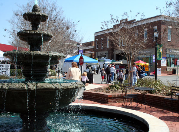 Image Source: Jane. Source License: CC BY-NC-SA 2.0.
Contact
Clear Springs Development Co.
951 Market St. Ste. 203, Fort Mill, SC 29708
877-570-HOMEAbout the Program
Baxter Village is a community on the edge of Fort Mill’s city limits in York County, South Carolina. Baxter Village lies at the juncture of I-77 and Highway 160 on property owned by the Close Family, developed with the intention of creating a new type of living experience in Fort Mill. The neighborhood was developed in the early 2000s in the New Urbanist style of development, which endeavors to recreate “traditional” neighborhoods with businesses and services and neighborhood services (i.e. schools, libraries, places of worship) located in a town center in walking distance to homes, complemented by parks and recreation facilities in close proximity. Including a range of housing types and price points is also a goal of traditional neighborhood development, so that all are welcome to live, shop, and recreate there. Because it was introducing land use types and densities that were not found elsewhere in the county, the development was created through the adoption of a Traditional Neighborhood Design (TND) zoning overlay district with York County, SC. Today it includes a YMCA, the Fort Mill Public Library, Orchard Park Elementary School, Piedmont Urgent Care Center, and the Baxter Town Center with a diversity of businesses to serve the community and the city as a whole.
Why it works
The York County Zoning Code contains a Traditional Neighborhood Design (TND) zoning district which promotes greater flexibility of land uses and densities than other zoning districts within the county. Many communities have such allowances in their zoning codes, either as TNDs or as PUDs (Planning Unit Development). The creation of such a district requires a rezoning application provided to the county, including the development program for the site and a pattern book, containing architectural guidelines. The development program also includes locations of different housing typologies of varying sizes and densities, such as apartments and condominiums, residential above commercial uses in a mixed use format, townhouses, and single-family homes in a range of sizes. This enables the combination of a variety of housing types into one neighborhood to promote housing diversity and a community consisting of a range of household types and sizes. The TND also includes locations for commercial development and street and public realm standards to achieve the compact neighborhood feel. Once adopted, development review for the area falls to the zoning administrator who then references the pattern book and regulations contained in the TND overlay. This tool is useful for creating a diversity of housing types in a suburban setting and offers opportunities for transit and bicycle connectivity, jobs within close proximity of housing, and balanced, diverse communities.