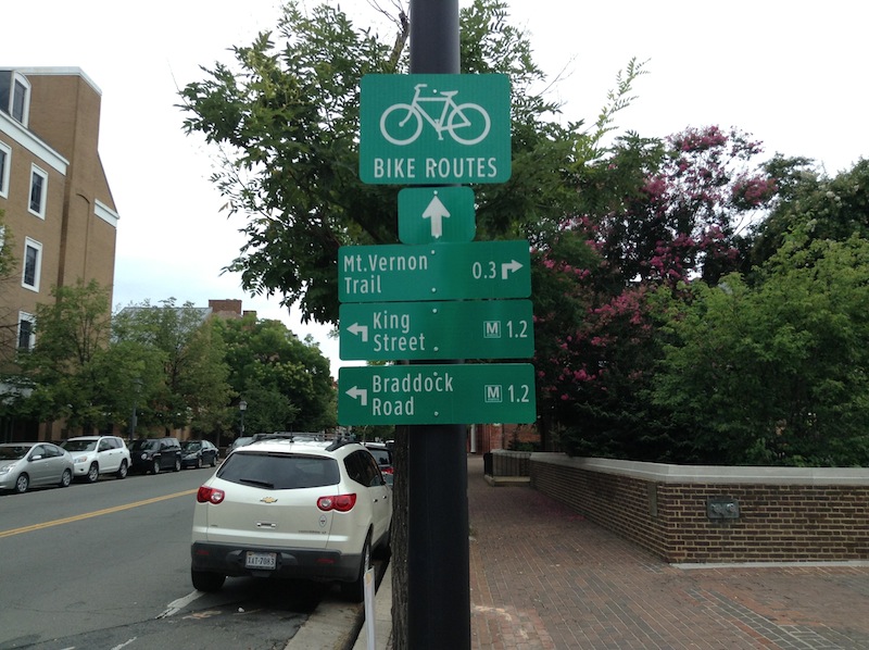
A comprehensive system of signage and maps that helps residents and visitors orient themselves to trails, bike paths, and transit routes. The “active” part of wayfinding is to highlight walking, biking, and transit paths, directions and distances, and provides ideas for how physical activity can be integrated into everyday work and recreation. Wayfinding signage and electronic apps can be designed to include average times between destinations, calories burned, and level of difficulty.
Why is this important to your community?
According to the CDC BRFSS surveys in 2011, the percentage of the residents in our region reporting no physical activity (over a month-long period) varied by county from about 15% to 31% of the total population. Our built environment – buildings, neighborhoods, schools, and transportation systems, influences how active people are in their everyday lives. Studies by Active Living Research and others have found that people who live near safe parks, in neighborhoods with sidewalks or bike paths, and transit options are more likely to use these amenities for recreation and travel. However, even where these resources exist, residents are not always fully aware of them or the connections between them. The CONNECT Our Future Public Health Work Group identified “active transportation” – a connected walking, biking, and transit network – as a key strategy to address inequalities in public health, and “active wayfinding” is one way of making walking, biking, and transit the easy choice.
Skip directly to
How Does It Work?
Resources
Using the Tool
Partners
Where Has It Worked?
Where is it appropriate to use?
What priorities does it address?
What other tools are related?
How does it work?
The idea of wayfinding (the signs, maps, and audible methods which help visitors get around a place) can be applied in a variety of ways to make it more convenient for people to access available pedestrian, bicycle, and transit routes. Many large cities are experimenting with a comprehensive wayfinding signage that includes walking distances between locations and shows connections between sidewalks, trails, and transit routes. Wayfinding can be implemented in communities of any scale through signage, public art, online maps and resources, and promotional materials.
Ready to get started?
Using the Tool
- Start with a municipal inventory of the community’s resources, including pedestrian, bike, and transit routes and plans, as well as any existing wayfinding systems. Involve regular users of your community’s walking and biking facilities – including bicycle organizations, trail, and recreation-based organizations.
- Design a community survey to understand the level to which residents use existing walkways, trails, and transit service (and what barriers they identify to greater use) in partnership with representatives from communitywide interests (e.g., parks and recreation department, school district, community health providers, transportation planners, public health experts, transportation agencies, bicycle and pedestrian organizations, tourism organizations).
- Use the results to recommend the type of wayfinding projects (e.g., coordinated signage program, online maps and electronic apps, wayfinding plan, guidelines, marketing materials) needed in your local community. Be sure to look at:
- The level of transit services available and how transit service connects with walking and biking routes
- Existing trail use for recreation and commuting
- The distances which residents are traveling by walking, biking, or transit to meet their day to day needs, and the extent to which they are using more than one mode to reach their destinations
- Existing awareness and use of walking, biking, and/or transit routes
- Existing barriers (e.g., safety concerns, gaps in the network) to using the existing routes
- Consider applying for grants to assist in funding through foundations or national organizations supporting public health and alternative energy or transportation modes like the Centers for Disease Control and Prevention, American Planning Association, and the Aetna Foundation (include links).
- At a municipal level, provide marketing support for wayfinding projects and related initiatives. Consider sponsorship and partnerships with local business, tourism, and/or health agencies to assist in developing and offsetting the cost of producing materials. Colleges, downtown organizations, and/or recreation providers may be interested in participating in the maintenance and updating of signage and electronic materials.
- Track user data and resident satisfaction with existing pedestrian, trail, and transit resources through user surveys.
Partners
- Advocacy Groups
- Airports
- Colleges and Universities
- Health and Wellness Programs
- Health Care Providers
- Landscape Architects, Planners, and Urban Designers
Where has it worked?
Wayfinding and Associated Programs - Arlington, VA
About the Program
To meet several community goals, including the promotion of walking, biking and mass transit use, the City of Alexandria adopted a Wayfinding Design Guidelines Manual in 2010. This manual includes guidelines detailing how the signs will look and how they’ll be maintained, as well as coordinating elements such as lighting and planting. Signage is being phased in throughout the city through Arlington’s CIP program and includes pedestrian, trail, and transit markers. In addition, there are several websites (e.g., Bike Arlington) geared toward helping residents find existing transit locations, trail, and bicycle resources (including maps of multi-use trails, tips for those new to biking, and links to the Capital Bikeshare program).
Why it works
Encouraging active transportation through a multi-pronged approach using design, wayfinding, educational, and marketing resources in Arlington is proving successful. The city and county have been long-time proponents of safe, complete streets and innovative transportation planning. Between 2000 and 2011, the percentage of commuters driving alone decreased and the percentage of those commuting by bike or transit increased in the Arlington region. In addition, the city is part of the Capital Bikeshare program, which has seen ridership increase each year since its inception in 2011.
- Airports


