Image Source: Lars Plougmann. Source License: CC BY-SA 2.0. Adaptations: cropped.
Green infrastructure refers to the network of natural systems that tie together the ecological functions of a community or a region, including protecting water and air quality, wildlife, undisturbed tree canopy, etc. Green infrastructure also provides a backdrop of natural character and aesthetic value. The notion of green infrastructure supports the integration of open space into all parts of a community in the form of tree canopy, parks, greenways and sustainable stormwater management.
Why is this important to your community?
The integration of green elements into the everyday functioning of a community and a region provides numerous benefits. First, preserving and creating natural elements, both within the developed portions of the city and at its edges, provides important habitat for native wildlife and plants. Second, the green infrastructure network can provide trail linkages between existing or new parks and open space, providing opportunities for outdoor recreation, active living, active transportation, and connecting residents with their natural surroundings. Such green networks also are an important amenity in attracting economic development and the “creative class” of entrepreneurs.
The CONNECT region encompasses a vast number of important open lands, recreation and water resources which will need to be preserved as population growth in the region increasingly strains the integrity and health of these natural elements. For example, sedimentation is documented as a current leading source of non-point source water pollutants, and occurs as sediment is carried by stormwater runoff into the regions’ streams and major rivers. Undeveloped, natural areas such as parks, greenways, and impervious surfaces help slow stormwater flows, reduce sedimentation, and mitigate flooding hazards. Natural areas thereby contribute to improving water quality, in addition to more efficiently recharging natural groundwater sources—a crucial element in managing water supply capacity.
Green infrastructure components such as trees, plants, and landscapes also improve the quality of the air we breathe, build resilience against extreme heat, drought, or severe storms, and reduce the urban heat island effect making the urban environment more comfortable. The most important component of green infrastructure is land conservation, as the undisrupted natural environment is the most desirable for carrying out intended natural benefits.
Where is it appropriate to use?
- Institutions
What priorities does it address?
What other tools are related?
- Tree Canopy Preservation
- Greenways and Trails Planning
- Growth Management and Cooperation
- Stormwater Best Management Practices (BMPs)
How does it work?
Creating a green infrastructure network may be approached at a variety of scales, but first it must be looked at regionally. Green infrastructure systems are related to watersheds and ecological communities which transcend political or jurisdictional boundaries. In North and South Carolina, water systems are managed on a region by region basis, corresponding to watersheds (through the states’ Division of Water Resources and Department of Natural Resources, respectively). Water regulations are designed to protect water bodies and water quality, and also the sensitive natural areas that surround them. These natural, riparian areas provide the backbone of a green infrastructure network.
The most important element of a green infrastructure system is the natural environment surrounding urban areas, so the highest priority in promoting green infrastructure is promoting land conservation in and adjacent to urban areas. Green infrastructure planning at the community-wide and regional scale can be augmented with tools such as “greenprinting,” developed by the Trust for Public Land and used by many conservation entities to determine areas most suitable for conservation by studying spatial data.
When conservation is not an option, or in areas that are already developed, a number of mitigation actions are available to help “green” an urban environment. Because human development has altered the footprint of many natural systems, green infrastructure plans attempt to restore the functionality of these networks by adapting built elements to work in conjunction with natural systems. Interventions attempt to simulate the functions of natural systems, encouraging natural filtration of water in urban areas and the inclusion of planted, pervious landscapes instead of pervious surfaces such as asphalt, concrete, and built area. Recommendations may include uncovering (or “daylighting) a stream or water course that may have been previously channelized or buried to create more land for development, or purchasing the housing built in a flood plain to convert the flood plain into a natural greenway that can support recreation and transportation uses, such Little Sugar Creek Greenway.
Planners, landscape architects, engineers, and ecologists have created terminologies to establish commonality among recommendations and to codify the practice of green infrastructure related to water quality issues. In general, this is defined as Low-Impact Development (LID), which is an approach to land development that attempts to mimic natural systems as close as possible. Under the umbrella of LID, are measures to preserve natural areas, as well as infrastructure planning that includes on natural measures and materials, rather than engineered. The measures themselves are called Best Management Practices (BMPs) BMPs seek to reduce stormwater runoff and allow for natural filtration, and include the introduction of street trees, rain gardens, bio-swales, rainwater harvesting systems, permeable pavers, green roofs, and water retention ponds in future development, including streets. Greenways, parks and open spaces, particularly adjacent to streams, share the dual role of BMPs and recreation/health/transportation facilities. Since parks and greenway planning is typically overseen through parks and recreation departments, while BMPs are overseen by public works and engineering, ensuring that urban green infrastructure serves all its potential purposes requires collaboration among these groups.
Resources
- EPA: Green Infrastructure
- EPA: Low Impact Development
- Green Infrastructure Center
- The Trust for Public Land (TPL): Greenprinting
- United Nations’ Green Infrastructure Guide for Water Management
- Agricultural Development and Farmland Preservation Trust Fund
- Clean Water Management Trust Fund
- Natural Heritage Trust Fund (repealed in 2013)
- Parks and Recreation Trust Fund
Ready to get started?
Using the Tool
- Pull out the Carolina Thread Trail (CTT) map and assess its implementation locally. How does the map and the plans it contains support existing plans for preserving open space, protecting streams or rivers, and supporting green infrastructure?
- If the community does not have such a plan, determine available funding to develop a regional, county, or city green infrastructure plan using available models such as TPL’s “greenprint” model. The CTT can be used as the “backbone” of a local plan, if it is widely accepted in the county, and coupled with local parks and recreation plans.
- Review park utilization figures and applied level of service metrics to determine if there are enough parks to meet community needs.
- With input from community stakeholders and the public, establish a data analysis process to determine areas of highest priority for conservation. Map the areas, determine the landowners, and include them in future discussions. Would they be willing to put their land in conservation for the future? If they plan to develop it, would they be open to a conservation subdivision? Hold a workshop with the local land trust on the benefits of conservation easements.
- Complete a plan that sets a framework of collaboration and priority setting to create a cohesive green infrastructure network. The plan should include maps, the rationale for priorities, and strategies for creating the green infrastructure. Consider if local legislation is needed, for example to permit regular clear-cutting, to enable implementation of the plan.
- Seek funding for the protection of discrete portions of the network through available national, state, and local programs, and through partnerships with conservation groups and land trusts, or through stewardship agreements. Identify barriers to putting land into conservation, and if funding of associated legal fees is a problem, as it is in some areas, consider the establishment of a legal fund to help support landowners who wish to place land in conservation—especially if the land is a priority in the local plan!
- Institutionalize green infrastructure planning procedures. Encourage land conservation, tree canopy protection, water resource, and park planning to align with objectives of the green infrastructure plan.
- Work with regional water quality control agencies to create guidelines for low-impact development (LID), including BMPs for site development if such regulations do not already exist.
Partners
- Advocacy Groups
- Colleges and Universities
- Community Development Organizations
- Community Service Providers
- Departments of Education / School Districts
- Developers
- Elected Officials
- Farmers / Agricultural Extension Office
- Health and Wellness Programs
- Housing Authorities
- Landscape Architects, Planners, and Urban Designers
- Land Trust
- Local Food Councils
Where has it worked?
Post Construction Storm Water Ordinance and Guidance - Huntersville, NC
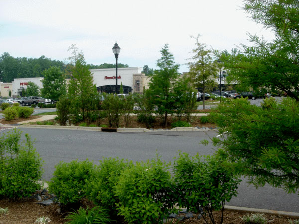 Image Source: Charles Rulick.
Contact
Rusty Rozzelle, County Water Quality Program Manager
Charlotte-Mecklenburg Storm Water Services County
704-336-5449
Rusty.Rozzelle@mecklenburgcountync.govAbout the Program
In June 2007, Huntersville passed a Post Construction Storm Water Ordinance that requires the use of Low Impact Development (LID) practices in all development and redevelopment. Huntersville’s embrace of LID stemmed from rapid development that affected water quality just upstream of the drinking water intake. The ordinance establishes storm water management requirements and controls to prevent surface water quality degradation within the town limits and its extraterritorial jurisdiction. Builders, engineers, and other professionals must consult the Huntersville Water Quality Design Manual and Site Evaluation Tools. The Water Quality Design Manual outlines how LID best management practices (BMPs) in combination with conventional management practices should be the primary mechanisms for complying with the ordinance. The Site Evaluation Tool (SET) is an Excel-based spreadsheet that is designed to aid in the assessment of construction plans and proposed BMPs to achieve water quality objectives.
Why it works
By supplementing the Storm Water Ordinance with the Design Manual and the SET, Huntersville has facilitated easier adoption of BMPs in the pursuit of improving water quality. The SET is useful as a screening tool to test various site and BMP configurations against water quality goals, and it can be submitted with a site plan as part of the approval process to demonstrate compliance. It is also helpful for evaluating impacts of various types of development and understanding the costs of treatment. As development and redevelopment occurs, the inch of runoff required by the ordinance to be managed through LID techniques removes 90% of the pollutants present in the stormwater—directly impacting the water quality of lakes and streams.
http://charmeck.org/stormwater/regulations/psges/lidhuntersville.aspx
Tonbo Meadow - Wilmington, NC
About the Program
Tonbo Meadow is a single-family cluster development designed with both green building and Low-Impact Development (LID) techniques to enhance the aesthetics and environmental qualities of the development. LID principles utilized on the property include reducing pollutants at the source, minimizing impervious surfaces, and using natural or existing drainage features. The design exceeds stormwater control requirements and provides treatment for stormwater from an adjacent property.
Why it works
Initially designed using a conventional plan layout, Tonbo Woods had room for five lots and a typical stormwater pond. By working with the City of Wilmington—which did not have an LID ordinance in place—to determine how to implement LID within the city’s development requirements, they were able to redesign the site to cluster development, protect large, undisturbed open space, maximize the preservation of mature trees, minimize impervious surfaces, and incorporate swales, rain gardens, and cisterns to manage stormwater. The developer anticipated that the high quality design of the community, including all of the green infrastructure it incorporated, would increase its livability and attractiveness, offsetting any additional construction costs and leading to a highly marketable and profitable development.
http://www.ces.ncsu.edu/depts/agecon/WECO/lid/documents/NC_LID_Guidebook.pdf
- Colleges and Universities
- Greenways and Trails Planning
- Tree Canopy Preservation